...
| Info |
|---|
If you have requested a coordinate system from CTI Technical Support, we will provide you with both GXP files necessary to use the new system. Skip down to the section on Importing a Custom Coordinate System from disk and be sure to import both GXP files provided. |
To Export a Custom Coordinate System to disk:
Select the Custom Coordinate System you want to export.
Click the Export button and save the coordinate system to disk.
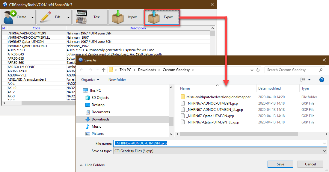
Repeat steps 1 and 2 for the “LL” version of the coordinate system.
To Import a Custom Coordinate System from disk
Note that you will need a pair of GXP files. The first should define the transformation from WGS84 to the Custom Datum (the “LL” version as specified above). The second should define both a transformation to the custom datum and a map projection (the “plain” non-LL version).
Click Import on the CTI GeodesyTools toolbar
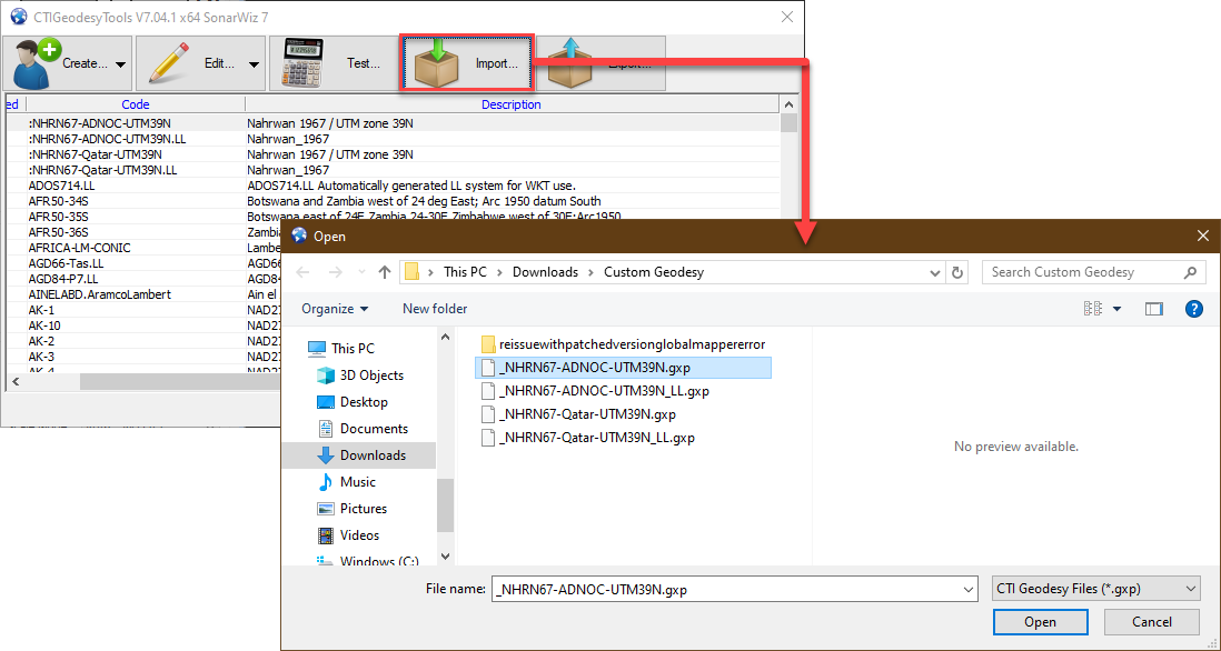
Select the first GXP file in the pair and click Open.
Repeat the process for the second GXP file.
Verify that two coordinate systems were imported. The first should be listed under the Latitude / Longitude group, the second should be listed under the User Defined Coordinate Systems group.
Related articles
| Filter by label (Content by label) | ||||||||||||||||||
|---|---|---|---|---|---|---|---|---|---|---|---|---|---|---|---|---|---|---|
|
...